Academic staff
Patrick LAUNEAU
Contact details
2 rue de la Houssinière 44322 Nantes
- Phone
- 0251125266 (n° interne : 455266)
- Patrick.Launeau@univ-nantes.fr
- Personal Website
- new page in progress
Taught academic discipline(s)
Research topics
Activities / Resume
Laboratory: UMR CNRS 6112
Laboratoirede Planétologie et Géodynamique (LPG)
e-mail: Patrick.Launeau@univ-nantes.fr
Qualifications
1991 PhD Université Paul Sabatier,Toulouse 3
2002 HDR Université de Nantes
Research in progress
in geology
- Structuralgeology based on digital image analysis of magma flow with cooperation inCanada (Toronto), Brazil (Sao Paulo) and field studies in France, USA, Brazil,Oman, South-Africa
- Remote sensingof petrology with hyperspectral airborne and satellite images in France, Spain, Oman, and Morocco
inenvironmental sciences (see publications*)
- Remote sensingof environmental parameters: microphytobenthos biomass and soil land cover withcooperation with biologist of Nantes University (MMS).
Main funding
Plan National deTélédétection Spatiale and Plan National de Planétologie (CNRS-INSU)
ACI Observation de laTerre, Région Pays de la Loire
Europeanprogram HySens
Teaching:
Structuralgeology in License and Master including field camps
Remote sensing in Master (research and professional)
Administration:
2004-2006 Associatedirector of the UMR CNRS 6112
2006-2008 Head of the department Sciences de la Terre et de l'Univers
since 2008 Head of OSUNA -Observatoire des Sciences de l'Univers NantesAtlantique
since 2010 Head of the UMS CNRS 3281 de soutienà l'OSUNA.
2004-2011 Head of the Master "Sciences de laTerre de l'Univers et de l'Environnement" (STUE)
2011-2013 Head of the Master " Terre, Planètes et'Environnement" (TPE)
Conference organisation:
Réunion des Sciences de laTerre, Nantes 9-12 avril 2002. www.sciences.univ-nantes.fr/geol/RST2002
Workshop of hyperspectral remote sensing in April 2007
Employmenthistory :
Professor at the University of Nantessince 2003
1993-2003Maître de Conférences (associate professor) Université de Nantes
1991/93 Post-doctor at the University of Toronto:International fellowship of NSERC Canada. Image analysis and structural studies
1991 (mars avril) Geologist atTotal Compagnie Minière France, Division Sud Massif-Central and the UniversitéPaul Sabatier Toulouse France : Tectonicstudy of U deposite in the Bertholène mine (Laissac, Aveyron, France)".
1987/90 Thesisat the laboratoire de Pétrophysique et Tectonique de l'Université Paul Sabatier(Toulouse, France)
1987 (mai à juillet) Geologue at the Centre de Recherches sur laGéologie de l'Uranium and SNEA-P (an ELF division) : Structural analysis of the Crozant granite(Marche, France) and link with U deposite.
1985 (juillet août) Geologistat the Bureau de Recherches Géologiques et Minières: Structural analysis in ashear zone area (West of Angers, France) for gold mining studies
PhD Thesis:
"Analyse numérique des images et orientationpréférentielles de forme des agrégats polyphasés" Université PaulSabatier, Géologie structurale et analyse d'image.
PhDdirections:
Direction
- Kazemipour F (2007-2010) Microphytobenthos radiative transfer and remote sensing of diatoms
- Baissa R. (2007-2010)Hyperspectral remote sensing of carbonates in Morocco
- Roy R. (2004-2007) Oman peridotiteremote sensing.
Co-direction
- Benyoucef (2011-2013) Hyperspectral remote sensing of microphytobenthos in Loire estuary
- Combe J.-P. (2001-2005) Hypersepctralstudy of Mars and Bougneuf Bay by MGM.
- Méléder V (2000-2003) VNIRremote sensing of microphytobenthos
-Auréjac J.-B. (1999-2004) Image analysis of magma flow in layered complex of South Africa.
Last jury of the year:
Damien Gaudin 12/07/2012 Universitéde Brest. Imagerie IR thermique haute résolution : potentiels et limitationspour la géologie, dir C. Delacourt, S. Allemand.
Annaelle Bargain 13/11/2012 Universitéde Nantes. Etude de la structure et de la dynamique des herbiers de Zosteranolti par télédétection multi et hyperspectrale, dir M. Robin, L. Barillé.
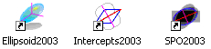
Productionof sharewares for image analysis of rock structures in cooperation with theUnversity of Toronto:
Intercepts2003,SPO2003 and Ellipsoid2003 are programs of image analysis available in the website of the UMR 6112
Publications(since 2009):
Arbaret, L., Launeau, P., Diot, H., Sizaret, S. (2012)Magnetic and shape fabrics of magnetite in simple shear flows, Journal of Volcanologyand Geothermal Research, doi: 10.1016/j.jvolgeores.2012.09.003
Kazemipour F., P. Launeau, V. Méléder (2012). Microphytobenthosbiomass mapping using the optical model of diatom biofilms: Application tohyperspectral images of Bourgneuf Bay, Remote Sensing of Environment 127 (2012)1-13
Kazemipour F., V. Méléder, P. Launeau(2011). Optical properties ofmicrophytobenthic biofilms (MPBOM): Biomass retrieval implication. Journal ofQuantitative Spectroscopy and Radiative Transfer, Volume 112, Issue 1, January2011, Pages 131-142
Picard D., L. Arbaret, M. Pichavant, R.Champallier and P. Launeau, (2011), Rheology and microstructures ofexperimentally deformed plagioclase suspensions, Geology, doi 10.1130/G32217.1
Baissa R., K. Labbassi, P. Launeau, B.Ouajhain, A. Gaudin (2010) "Analyse hyperspectrale des carbonatesjurassiques dans le Haut Atlas atlantique marocain : exemple du Lias inférieurde la formation d'Arigh Ouzla (bassin d'Essaouira)". Comptes Rendus Geoscience, Volume 342, Issue 12, Pages 911-920
Launeau P., Archanjo C. J., Picard D., Arbaret L.,Robin P.Y. (2010). Two- and three-dimensional shape fabric analysis by theintercept method in grey levels. Tectonophysics, Volume 492, Issues 1-4, 20September 2010, Pages 230-239
Roy, R., P.Launeau, V. Carrère, P. Pinet, G. Ceuleneer, H. Clénet, Y. Daydou, J.Girardeau, and I. Amri (2009), Geological mapping strategy using visiblenear-infrared-shortwave infrared hyperspectral remote sensing: Application tothe Oman ophiolite (Sumail Massif), Geochem. Geophys.Geosyst., 10, Q02004, doi:10.1029/2008GC002154.
Freeware
Ellipsoid v2016
SPO v2017
Intercepts v08/2015
Short cours with examples and applications :
Fabric and SPO analysis v2h.pdf
One example of intercepts processing in grey levels.pdf
Special case of faults and lineaments